Home › Destinations › Dartmoor
Dartmoor
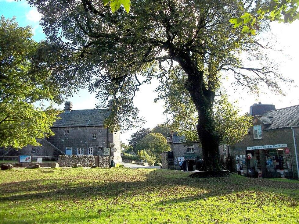
Dartmoor is a national park of high, open moorland in the middle of Devon, about 950 square kilometres of granite upland with rocky tors on the skyline, ponies and sheep grazing among the bracken, and deep wooded valleys around the edges. The highest point, High Willhays on the northern moor, is a little over 620 metres. Its landscape is unusually rich in prehistoric remains: stone rows, stone circles, burial cairns and the foundations of Bronze Age roundhouses lie scattered across the moor. Villages of granite cottages, inns and churches sit in the valleys and on the fringes.
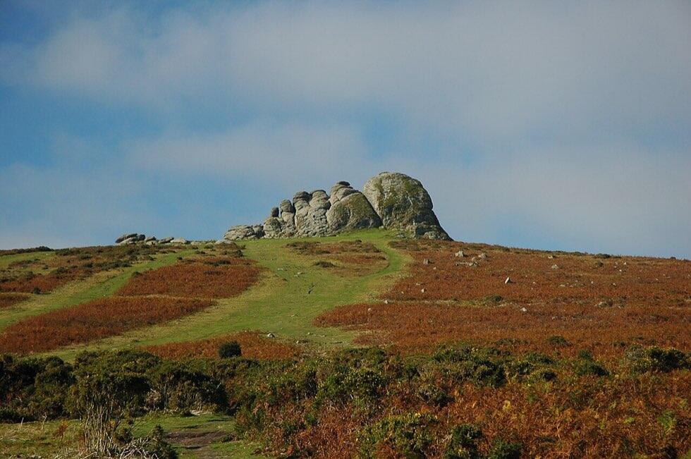

It suits walkers, cyclists, families who want space, and anyone who wants a quiet base within easy reach of both coasts. It is not a place for a rushed visit: the roads are slow, the weather can change in minutes, and the best of it is found on foot.
Getting there and around
Dartmoor lies between Exeter, Plymouth and the Torbay towns. By car, the A38 runs along the southern edge, the A30 along the northern edge, and two roads cross the middle, the B3212 and the B3357, meeting at Two Bridges. Moorland roads are unfenced in places: ponies, sheep and cattle wander onto them, and drivers must slow down, especially at night.
By train, the Dartmoor Line from Exeter to Okehampton reopened in 2021, giving direct access to the northern moor. Ivybridge and Totnes stations, on the main line, are useful for the southern edge. Bus services cross the moor in summer and link the towns around it year round, though not frequently. A car makes life simpler, but walkers with a plan can manage without one.
Highlights
- Haytor: the best-known tor, a massive granite outcrop near Bovey Tracey with a car park, views over Torbay, and the remains of an 1820s granite tramway that carried stone down to the canal.
- Hound Tor: a dramatic jumble of rock nearby, with the ruins of a deserted medieval village in the hollow below.
- Widecombe-in-the-Moor: a village in a valley with a tall church tower known as the Cathedral of the Moor, and the setting of the traditional song about Widecombe Fair, which is still held each September.
- Postbridge: a hamlet on the East Dart with a medieval clapper bridge made of huge granite slabs.
- Wistman's Wood: an ancient, stunted oak wood growing among boulders covered in moss and lichen, a short walk from Two Bridges. Stay on the path; the wood is fragile.
- Princetown: the highest town on the moor, home to Dartmoor Prison and the national park's main visitor centre.
- Dartmeet: where the East and West Dart rivers meet, with riverside paths and a popular car park.
- Lydford Gorge: a deep, wooded river gorge with a waterfall, run by the National Trust on the western edge.
- Castle Drogo: an early twentieth-century granite castle designed by Edwin Lutyens above the Teign gorge near Drewsteignton.
- Buckfast Abbey: a working Benedictine monastery near Buckfastleigh, rebuilt by its monks in the early twentieth century.

Walking safely
Many walks start from roadside car parks, and short circuits around Haytor, Hound Tor or the Dart valley are easy for most people. On the open moor, though, there are few signposts and many paths are faint. Carry a proper map, such as the Ordnance Survey Explorer maps for Dartmoor, and know how to use it. Mist can come down quickly and turn a familiar tor into an anonymous grey shape. Ground can be boggy, and rivers rise fast after rain.
Parts of the northern moor are used by the Ministry of Defence for live firing. Ranges around Okehampton, Merrivale and Willsworthy are marked by red and white posts. When firing is planned, red flags fly by day and red lamps by night, and the times are published in advance. Check the firing times before you walk in the north, and never pick up metal objects.
Dartmoor ponies are owned by farmers and are not tame. Do not feed them; it draws them to the roads, where they are hit by cars.
Wild camping
Dartmoor is the only national park in England where backpack camping is permitted in certain areas without the landowner's permission. The rules have been the subject of court cases in recent years, so check the national park authority's current camping map and code before you go. Camp for one or two nights only, out of sight of roads and houses, and leave no trace.
Where to stay
The moor's towns, such as Ashburton, Bovey Tracey, Moretonhampstead, Chagford, Okehampton and Tavistock, have inns, guest houses, shops and restaurants, and work well as bases. Villages such as Widecombe, Lustleigh, Postbridge and Belstone have pubs with rooms, B&Bs and cottages. There are also farm stays, bunkhouses, youth hostels, camping barns and a handful of country-house hotels in the valleys. Book ahead in summer and at Easter.
If you want both the moor and the sea, stay on the edge: Bovey Tracey or Ashburton put the south Devon coast and Torbay within half an hour, and Okehampton is handy for the north coast via the A30.
When to go
Late spring and early summer bring lambs, foals, birdsong and long evenings. August is busy at the honeypot car parks but quiet a mile from them. Autumn turns the bracken copper and the valley woods gold. Winter can be harsh on the high moor, with snow some years, but clear days are crisp and beautiful. Bring waterproofs whatever the season.
A two-day plan
Day one: walk the circuit from Haytor to Hound Tor and back via Becka Falls or Greator Rocks, with lunch in Widecombe. Day two: drive across the moor to Postbridge to see the clapper bridge, walk to Wistman's Wood from Two Bridges, and finish at Lydford Gorge or the visitor centre in Princetown.
For the coast nearby, see Torquay and Teignmouth. For a city base with trains to Okehampton, see Exeter.
Frequently asked questions
Do I need a map on Dartmoor?
For anything beyond a short walk from a car park, yes. Paths on the open moor are often faint and signposts are rare. Mist can reduce visibility to a few metres. Carry a paper Ordnance Survey map and a compass, and know how to use them; phone signal is unreliable on the high moor and batteries drain quickly in the cold.
When are the firing ranges in use?
Live firing takes place on parts of the northern moor on published days. The schedule is issued in advance by the Ministry of Defence, and red flags by day and red lamps at night mark ranges in use. When there is no firing, the ranges are open for walking. Always check the schedule before walking in the Okehampton, Merrivale or Willsworthy areas.
Can I swim in Dartmoor's rivers?
Many people swim in the Dart and other rivers in summer, at popular spots such as around Dartmeet and below Sharrah Pool. Rivers can be very cold, fast-flowing and deep, and levels rise quickly after rain. Only swim if you are confident, never alone, and stay out after heavy rain. Respect private land and car parks.
Is Dartmoor good for families?
Very good. Short walks to tors from car parks at Haytor, Hound Tor and Combestone are within reach of young children, as are the river at Dartmeet and the clapper bridge at Postbridge. Letterboxing, a Dartmoor tradition of searching for hidden boxes with rubber stamps, is popular with children. Bring layers and waterproofs even on fine days.
Guide me to UK is an independent information site. We do not own hotels or take bookings. Fares, opening hours and timetables change, so confirm them before you travel. Last updated 1 November 2026.